
THE DRONE PACS
AeryxIQ applies the hospital imaging playbook — PACS — to drone inspection. Dump the SD card; get organized, graded, hash-sealed studies with longitudinal condition intelligence on every asset you fly.
Every asset a patient. Every flight a study. Every frame evidence.
Cloud-hosted · Multi-tenant · Evidence-sealed · An Amhage Technology Group LLC company
Drone programs generate imagery faster than any team can organize it — and the value dies in the folder.
Flights live in Dropbox folders named "DCIM_final_v2". Nobody can find last year's blade shots when the crack appears.
Every inspection starts from zero. The slow corrosion that becomes a $2M replacement was visible three flights ago.
An insurer, court, or regulator asks: "prove this image is unaltered and from that date." A folder of JPEGs can't answer.
Capital requests without defensible data lose to whoever shouts loudest. Condition-based planning needs the record.
Hospitals never lose an X-ray, always find the prior, and read every study on a disciplined workstation. That system is called a PACS. AeryxIQ is a Drone Picture Archiving and Communication System — the same discipline, aimed at everything a drone can see.
| In the hospital | In AeryxIQ |
|---|---|
| Patient | Asset — turbine, bridge, field, crime scene… |
| Study (X-ray, MRI) | Mission — one flight over one asset |
| Series & images | Media sets & geotagged frames |
| Radiologist's read | Graded findings G1–G5 on a diagnostic Workstation |
| Prior comparison | Side-by-side priors + AI change detection |
| Signed report | Finalized, hash-sealed report with a public verification certificate |
Drop the whole SD card — or let the agent do it. GPS decides the asset.
Images auto-group into studies by flight time — one mission per flight.
Diagnostic Workstation: window/level, LUTs, measure, annotate, dictate.
Code findings G1–G5. Criticals alert the whole org until acknowledged.
Priors auto-hang. AI proposes what changed since the last flight.
Finalize: every frame hashed, certificate minted, custody logged.
A CT scanner does not wait for a technologist to name a folder. It queries the worklist, acquires, and pushes the study back. We built the same loop for drones — and the worklist half is the half everybody forgets.
The pilot’s laptop pulls today’s inspections — overdue first, each one carrying what the last study found. You know which blade to re-shoot before you take off.
Put the card in and walk away. The agent waits for the copy to finish, then uploads. Nothing to name, nothing to sort.
Each frame’s GPS picks the asset. Capture times split the pile into flights. One study per sortie, filed against the right structure, with the prior already hanging next to it.
A frame it cannot place — no GPS, or no registered asset nearby — is reported, not filed somewhere plausible. A misfiled study is worse than an unfiled one: the archive is the product, and a wrong prior poisons every comparison you make for the next decade. Register the asset and the pending frames file themselves.
Your originals stay exactly where they are. The agent is one readable file with no dependencies — read the whole thing before you run it, which is the least you should expect from software asking to hold a key to your archive. Revoke that key from Settings and it stops on the next request.
Works with any drone that writes GPS to its photos — which is all of them. Docked fleets and cellular aircraft can push directly; everyone else gets the same result from the laptop they already own.
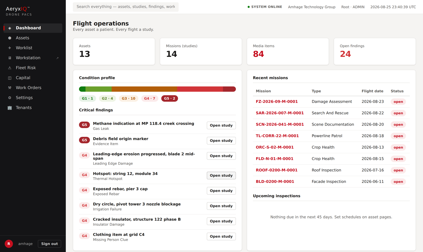
Real product, real workflow — this is the software running at app.aeryxiq.com today.
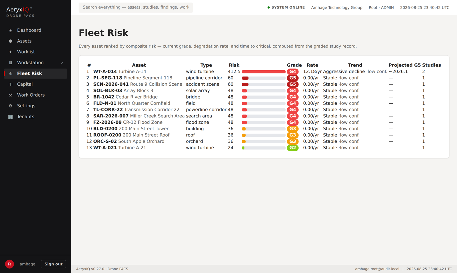
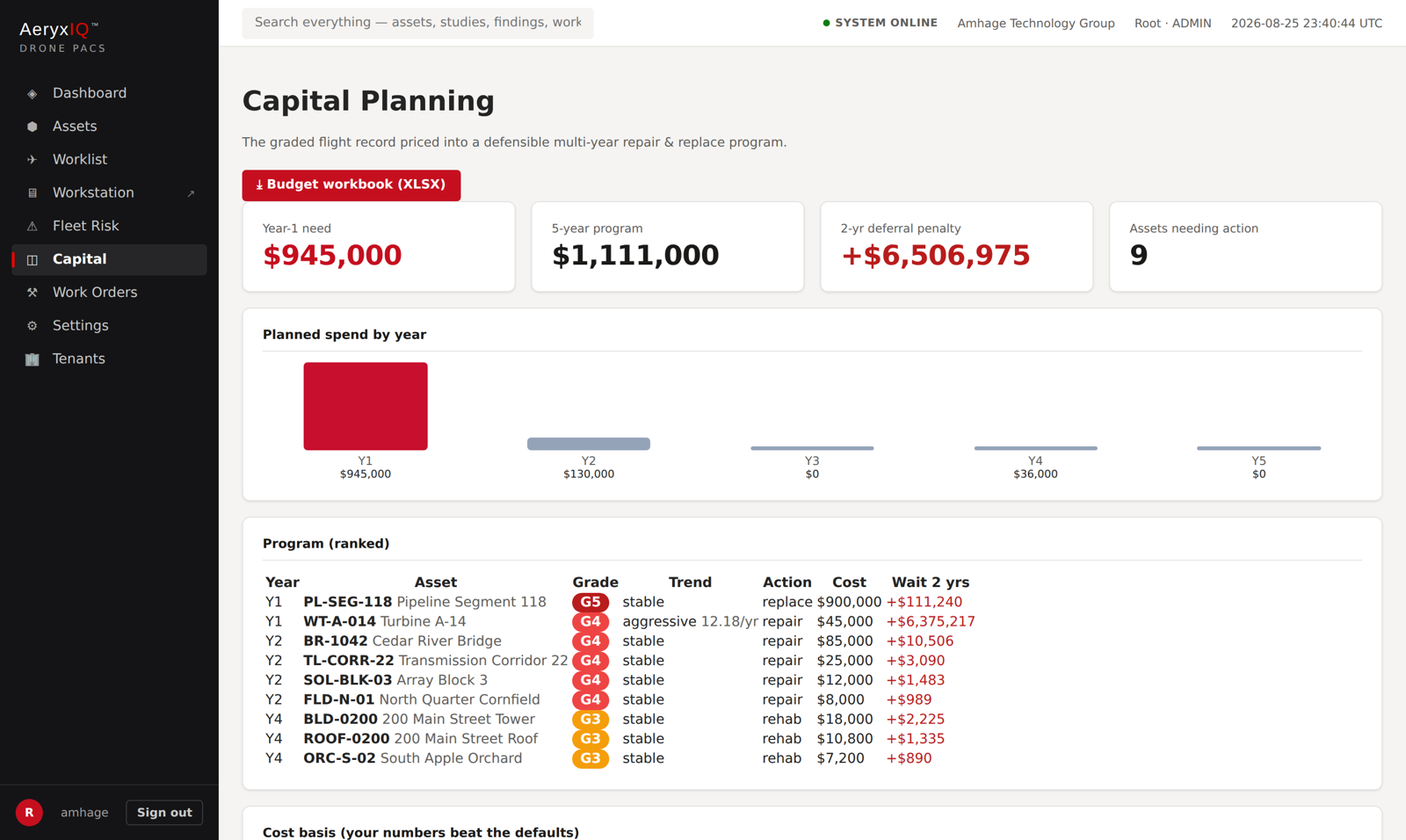
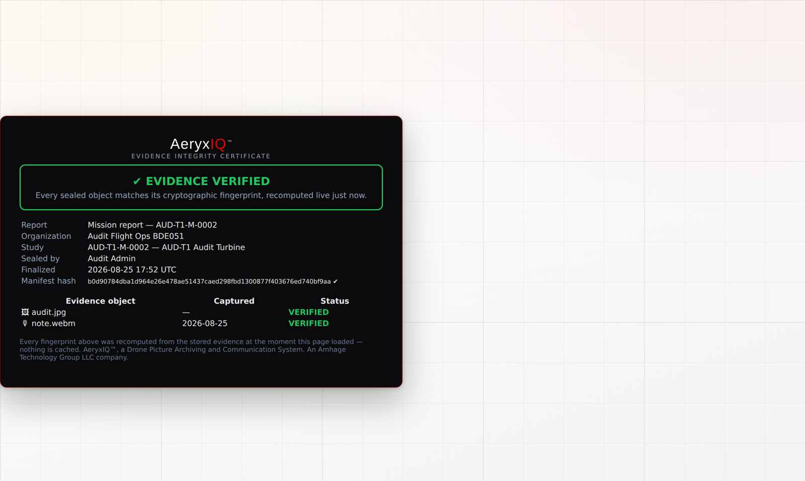
SD-dump ingest, EXIF/GPS parsing, flight auto-split, SHA-256 on every frame.
Put the card in and walk away. GPS picks the asset, capture times split the flights.
What is due to be flown, overdue first — pulled by the pilot, or by the aircraft itself.
Chromeless reading room: worklist, window/level, LUTs incl. crop-health VARI, loupe, cine.
Arrows, ellipses, angles, calibrated areas — saved to the study, printed on reports.
Aligns this flight to the prior and proposes what changed. Accept a proposal as a finding.
Degradation rate per asset, decline bands, projected year of reaching critical.
The "what do I worry about first" screen — composite risk ranking across the fleet.
5-year repair/replace program, deferral penalties, grant-ready XLSX workbook.
Hash-sealed reports, public live verification, amend visibly breaks the seal.
G4+ findings demand human acknowledgment — who and when goes to the custody log.
FAA Part 107 and friends tracked per pilot; every study checks its pilot's certification.
Contours, flow paths, HAND flood stages, cost screening from mapping flights.
Findings become jobs; every event lands on the asset's longitudinal chart.
Turbine blades, solar arrays, substations, powerline and pipeline corridors, tanks, flare stacks.
Bridges, dams, culverts, roofs, towers, runways — the civil backlog, finally with memory.
Fields, orchards, vineyards, pivots, livestock. Crop-health VARI from plain RGB — no multispectral needed.
Scene documentation with chain of custody and sealed evidence that stands up in court.
Progress tracking, stockpiles, flood prediction, earthwork and construction cost screening.
The demo is the product. Create your own private workspace, flip on the demo portfolio, and read studies across nine drone verticals.
Two and a half minutes, no voiceover — headphones optional. Every screen is the live platform at app.aeryxiq.com. About the portfolio shown: it is the built-in demo data. The aerial photographs are real; the change between the two flight dates is synthesised so the comparison can be demonstrated before you have flown an asset twice yourself.
One form: company, name, email, password. Your workspace exists in seconds.
Settings → Demo data → ON. A realistic portfolio loads: wind, solar, bridge, farm, public-safety studies with graded findings.
Open Fleet Risk, launch the Workstation, run AI change detection, seal a report and open its public certificate.
Drop a real SD-card dump on any asset — your imagery becomes studies automatically. Turn demo data off anytime; it purges clean.
Point solutions charge per user per map. AeryxIQ prices the whole discipline — and publishes the number, which almost nobody in this category does.
An archive is worth little on day one and everything in year two. These close that gap by hand — one-time, on any plan.
Hand us the folders. We ingest your historical jobs — photos, EXIF, GPS, existing PDFs — register the assets, and organise everything into dated studies against the right structure. You arrive with two years of history already in place, so the prior-study overlay works on your very first new flight.
Scope my archiveEverything in Archive Migration for one year of history, plus we set the platform up as yours: asset registry, your branding on reports and the client portal, user roles, re-inspection schedules and alert thresholds. Then two live sessions reading your own studies alongside your team, and a report template your clients will recognise.
Book a launchYour trade’s vocabulary, your grading rules. We extend the component map for the structures you actually fly, align the severity scale to the standard your clients cite, and build the finding categories and report language your inspectors already use. Delivered as your workspace’s own configuration.
Discuss my verticalWe are looking for ten working drone operators to put real flights through AeryxIQ. If that is you, Archive Migration is free — we import your last two years, you tell us honestly what breaks, and your name goes on the platform that fixes it.
Every physical asset on earth deserves a medical record. Aerial imaging is how that record gets written — if it's archived with the same discipline medicine applies to the human body.
Give every drone program — from a solo Part 107 pilot to a state DOT — the archive, the reading discipline, and the evidentiary integrity that turn flights into institutional memory and memory into better decisions.
AeryxIQ is an Amhage Technology Group LLC company, based in Rochester, New York — sibling to InspectryxIQ (industrial NDT imaging) and NeuryxIQ. Founded by Michael Romansky, applying two decades of enterprise imaging and security discipline to the physical world.
Private workspace in 60 seconds. Demo portfolio included. No credit card.
Start your free trial